Multitouch Earth
Dieser Post ist auch verfügbar auf: Russian
Scope and description
Passengers of a ship traveling the oceans of the Earth may find themselves quite bored. At such times they may want to know more about their location and travel and about places they visited and are about to visit. They may also want to examine geographical components of the data they already have.
Multitouch Earth is a program that can provide entertainment and education related to geography and Earth. The following is a short sample list of tasks that may be performed within Multitouch Earth.
1. Examine current ship location
2. Examine the route that ship took to get to the current location.
3. See the route the captain plans to take to reach the final destination
4. Create sample routes for the current destination and other destinations
5. Learn more about various places on Earth.
6. Look at the photographs that have geo information (latitude/longitude) on the map
This software help you to find the quickest or safest route on your next trip.
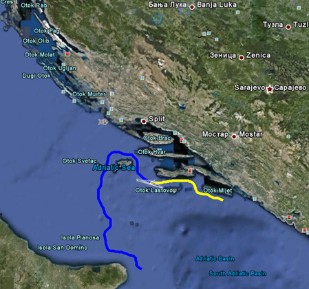
Next figure shows how Multitouch Earth displays the historical route (“how did we get here”) and the current captains planned route.


 English
  Русский